Thames Estuary Boat Trip: Maunsell Forts, Shipwrecks, and Wildlife
Did you know the Thames Estuary held such hidden heritage, just off our shores? Those distant shapes, seen from Kent and Shoeburyness, sparking endless questions – today, we’d finally get the opportunity to explore on our Thames Estuary boat trip.
Stepping aboard Brownes Thames Estuary Boat Trips’ private boat tour, excitement surged. We knew the sites we’d see, but little did we realise just how truly memorable the experience would be.
With the October sun warming us, a picnic packed, and warm clothes, we set off, eager for adventure, unaware of the magic that awaited. Let’s dive in.
TABLE OF CONTENTS
Our Thames Estuary Itinerary
Please note that this post contains affiliate links. This means that if you purchase a product through one of these links, I may receive a small commission at no extra cost to you. This helps support my blog and allows me to continue creating high-quality content.
Southend Pier: A New Angle on a Familiar Landmark
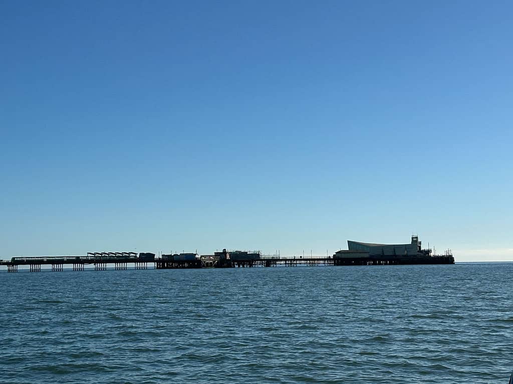
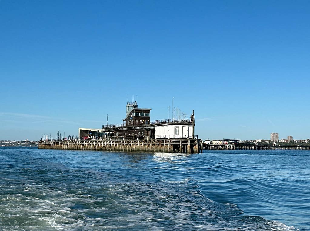
We’ve walked it, we’ve ridden it, but until this boat trip, we’d never truly seen Southend Pier from the Thames Estuary. From our vantage point on the water, the pier took on a whole new dimension. Its impressive length, stretching out into the Thames, was even more striking. The familiar landmarks—the train gliding along the railway, the distant figures of people strolling along its length—looked different, almost miniature, against the backdrop of the open water.
It’s easy to take Southend Pier for granted when you live nearby, but seeing it from this perspective made me appreciate its grandeur and historical significance. As the world’s longest pleasure pier, it’s a symbol of Southend’s appeal as a seaside destination.
If you love piers as much as I do, you’ll want to read more about Southend Pier’s history and attractions in my dedicated blog: SOUTHEND PIER: Here’s why you need to visit
What’s your favourite pier in the UK, and why? I challenge you to trump Southend Pier.
Southend Mulberry Harbour


Our first World War II stop was the Phoenix caisson, referred to locally as ‘The Mulberry Harbour,’ that lies on the West Knock sandbank, approximately 1.2 miles off Thorpe Bay shore. This massive concrete structure was destined to play its part in the “Mulberry Harbour,” a network of such structures to be used in the Normandy landings during D-Day for the rapid re-supply of troops. However, disaster struck when it sprung a leak while being towed from Immingham to Southsea. It was instead diverted to the Thames and intentionally sunk.
Today, it stands as a Scheduled Monument, and whilst it can be viewed from shore, many choose to walk out to it at low tide. However, remember, the Thames Estuary is notorious for its rapidly incoming tides, which can sweep in from unexpected directions, and the sandbanks pose a significant risk of becoming stranded.
Knock John Maunsell Fort


I never knew this one existed before discussing the trip with my family, considering my interest in such structures, it surprised me.
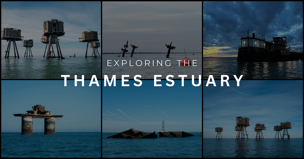
Knock John, also known as HM Fort Knock John or “The Goalpost” by some, is a Maunsell Sea Fort located in the Thames Estuary. Built in 1942, it’s one of a series of imposing concrete structures that emerged from the water during World War II. These enigmatic giants, designed to protect London from air attacks, are a testament to human ingenuity and a reminder of a unique chapter in British history.
After the war, Knock John was decommissioned, but was repurposed as the base for Radio Essex, a popular pirate radio station. Due to its more robust construction, it was considered a more secure location than some of the other forts. Over time, like the other forts, it has suffered from weathering and neglect, but its strong structure has helped it remain relatively intact compared to some of its neighbours.
Intrigued? Head over to my dedicated Knock John blog to read more: KNOCK JOHN MAUNSELL FORT: A WWII Relic Still Standing
Shivering Sands Maunsell Fort


As we approached Shivering Sands Maunsell Fort (also know as Shivering Sands Towers), I could feel the excitement bubbling inside me. For years, I’d dreamt of getting up close to these amazing structures, and today was finally the day! These weathered, skeletal towers, with their rusted frames, rose from the water, a stark and powerful reminder of their crucial role in World War II.
The Shivering Sands Towers are a testament to wartime engineering and strategic planning. Built to defend the Thames Estuary during World War II, these structures were a vital part of Britain’s anti-aircraft defence. Constructed on land in Gravesend, Kent, they were then meticulously positioned in the Thames Estuary in 1943.
Shivering Sands was one of three Army-constructed Maunsell Forts, alongside Red Sands and Great Nore, each fort consisting of seven interconnected towers designed to protect the Thames Estuary from aerial threats.
After the war, Shivering Sands, like other Maunsell Forts, was decommissioned. However, it gained notoriety in the 1960s when it became a base for pirate radio stations, including Radio Sutch and later Radio City. Over time, the fort fell into disrepair, battered by storms and the harsh marine environment.
To delve deeper into the fascinating history of Shivering Sands, be sure to check out my dedicated blog post: SHIVERING SANDS MAUNSELL FORT: A Piece of WWII History
Red Sands Maunsell Fort

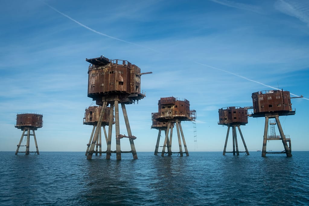
Finally, we reached Red Sands. This was it – the Maunsell Fort that had first ignited my curiosity, the one I’d encountered in countless images and documentaries. Its iconic status, I believe, is largely attributed to the work of the Project Redsand. Their tireless efforts to preserve this historical landmark have ensured that future generations can experience its significance firsthand.
Like its sister fort, Shivering Sands, Red Sands Maunsell Fort was constructed during World War II, serving as a vital anti-aircraft defence. And, similar to Shivering Sands, it also played a role in the vibrant era of pirate radio broadcasts.
Stay tuned! A dedicated blog post delving deeper into the history and preservation of Red Sands Maunsell Fort (also know as Red Sands Towers) is on its way.
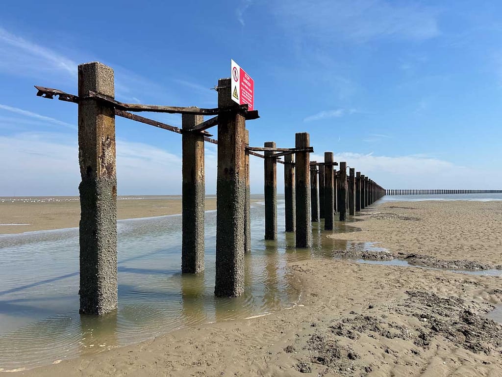
Did you know? The Shoeburyness Boom, just along the coast at Shoebury East Beach, is linked to the iconic Maunsell Forts. Discover more on my dedicated blog post about the Boom: SHOEBURYNESS BOOM: History, and Coastal Beauty in Essex
Dolphin Watching: An unexpected gift from the Thames
As we steered away from the imposing Red Sands Fort, a ripple in the water caught our eye. At first, we thought it might be the local seal colony, but then… a flash of grey, a sleek fin slicing through the waves – DOLPHINS! A chorus of gasps and excited shouts filled the boat as we scrambled for cameras, fully expecting a fleeting glimpse. Little did we know, these magnificent creatures had decided to join our adventure.
For the next hour, they joined alongside our boat, leaping and diving from the water. With the sun low in the sky, the light was glistening from their backs, making for a picqueisque view you only see in photos.
They stayed with us all the way to the SS Richard Montgomery, disappearing just before we reached the shipwreck. It was pure magic. People pay fortunes for this kind of wildlife encounter, and we were gifted it, a truly unforgettable moment. We were incredibly lucky that the tide allowed us the extra time to enjoy this spectacle.
SS Richard Montgomery Ship


“A ship loaded with 1,400 tonnes of explosives, wrecked in the Thames Estuary since 1944.” For years, that description felt like something from a thriller, an impossible scenario. But seeing the skeletal masts of the SS Richard Montgomery pierce the water’s surface, the reality of that danger hit home. It’s no longer just a story, it’s a very real threat.
I’ve always imagined the scene playing out like a dramatic movie sequence, with warnings of impending doom. “This ship could blow at any moment!” But the truth is far more sobering. In August 1944, this American Liberty ship, carrying a deadly cargo of munitions, simply ran aground on the Nore sandbank. A significant “oopsie daisy” that continues to pose a risk to this day.
As we cautiously circled the wreck, our skipper kept us well outside the marked exclusion zone – a stark reminder of the potential danger lurking beneath the surface.
For the first time, I could truly picture the ship’s hull resting on the estuary floor. It was no longer just masts; it was a ship, a time bomb, a piece of history frozen in time.
The Thames at Night


As the sun dipped below the horizon, we began our return journey, and by the time we reached the shore, the darkness had enveloped us. Southend-on-Sea at night out in the Thames Estuary was a whole new experience in itself, a moment of tranquility as the river seemed to soften to bustling seafront life, and was the cherry on top of our wonderful day trip.
Our Thames Estuary Route: A Visual Guide
To help you better understand our day exploring the Thames Estuary, we’ve included an interactive Google Map of our boat trip. Click on the markers to view the sites we visited along our route.
- Starting Point: Our journey began at Leigh Marina.
- Southend Pier: We passed by the iconic Southend Pier, offering a unique perspective from the water.
- Mulberry Harbour: You can see where the Phoenix caisson lies sunken, located on the West Knock sandbank.
- Maunsell Forts: Note the locations of Knock John, Shivering Sands, and Red Sands forts, and observe their distance from the shore.
- SS Richard Montgomery: See where the ship ran aground and remains wrecked.
Concluding Our Unforgettable Day
We were left speechless by the breathtakingly brilliant day out, and we are already longing to repeat the experience.
Our thanks go to Brownes for taking us aboard Starfish, ensuring our safety throughout, and providing an exceptional tour. Angus, our skipper, and his crewmate Henry made the trip effortless and enjoyable.
LET’S GO AGAIN!!
Looking for more to do in Southend? Find inspiration for your next trip with The Ultimate Guide to Southend-on-Sea: More Than Just A Beach Town.

To learn about the history of the SS Richard Montgomery and the danger it presents to the people of Kent, Go to
“The Richard Montgomery matter”https://www.ssrichardmontgomery.com