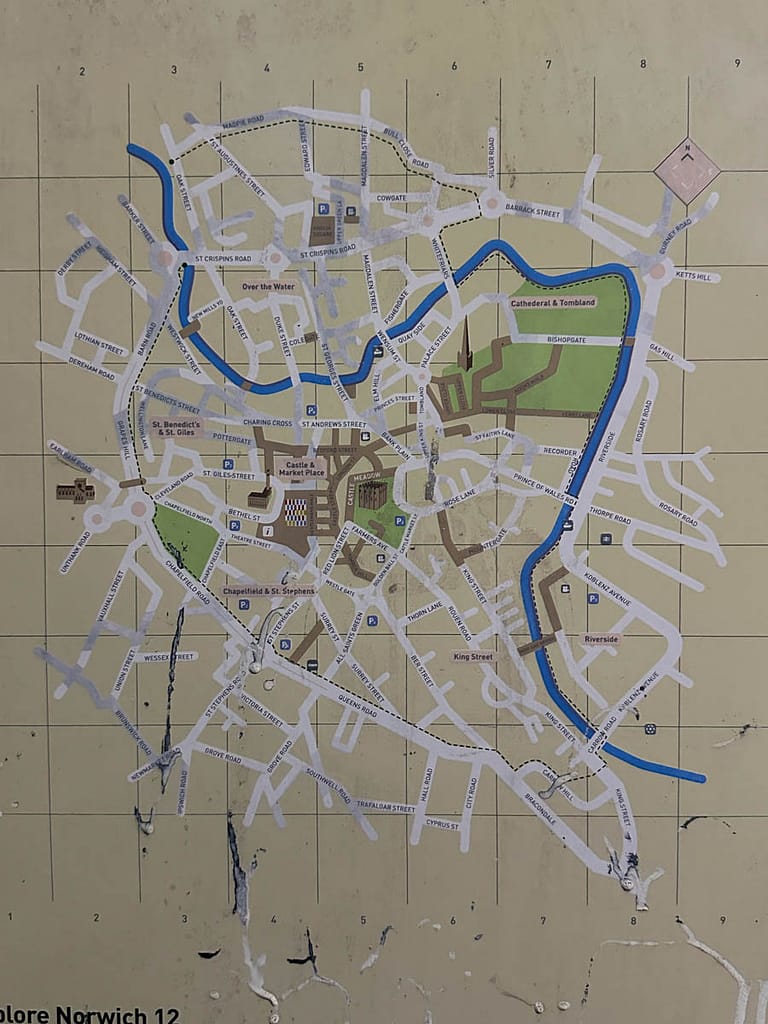
Your Guide to the Norwich Riverside Walk: Step-by-Step
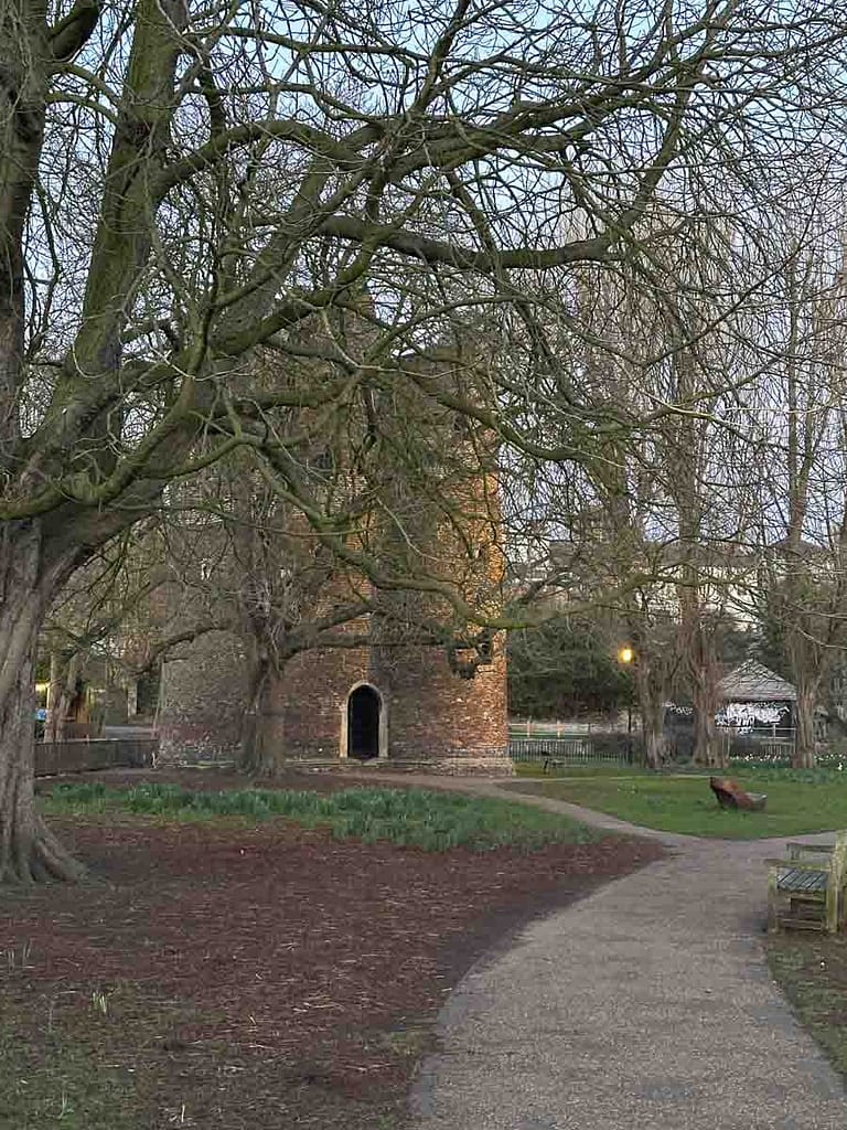
Exploring the Norwich Riverside Walk, a fantastic walking route in Norfolk, nearly didn’t make the cut for our micro break. Not because this city centre walk along the River Wensum wasn’t worthy – there are just so many great things to do in Norwich that we had a job fitting everything in! So, after a walk over to the Black Tower and Wall, we checked the time and set on a brisk walk along the Riverside Walk.
There is nothing better than a walk with interesting sights to see along the way, and actually, I rarely embark on a trail that doesn’t have a reward! This particular route offers a delightful blend of historical landmarks in Norwich, picturesque river views along the Wensum, and even a potential pub stop or two, making it a great addition to any short break in Norwich.
Please note that this post contains affiliate links. This means that if you purchase a product through one of these links, I may receive a small commission at no extra cost to you. This helps support my blog and allows me to continue creating high-quality content.
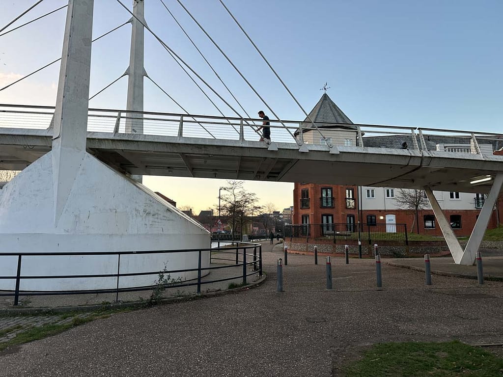
Starting Your Norwich Riverside Walk at Carrow Bridge (A147)
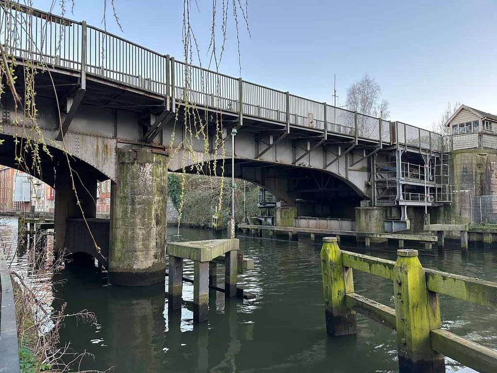
Step 1: Start at Carrow Bridge (A147). Cross the bridge from King Street.
We began our Norwich Riverside Walk experience at Carrow Bridge (A147), after arriving from King Street Norwich. Our first point of interest was the bridge itself.
Carrow Bridge Norwich: History & Lifting Mechanism
On the western side of Carrow Bridge, the small control building still sits. This structure once operated the bridge’s lifting mechanism.
Carrow Bridge, a single bascule bridge built in 1923, played a vital role in Norwich’s industrial past, facilitating trade to the riverside factories and warehouses. Although, its lifting function is now rarely used and faces potential permanent closure.
Step 2: Descend to the riverside on the right after crossing Carrow Bridge.
By crossing Carrow Bridge and then descending to the water’s edge on the eastern side (turn right after crossing the bridge), we could appreciate how its lifting mechanism once allowed larger vessels to navigate the River Wensum.
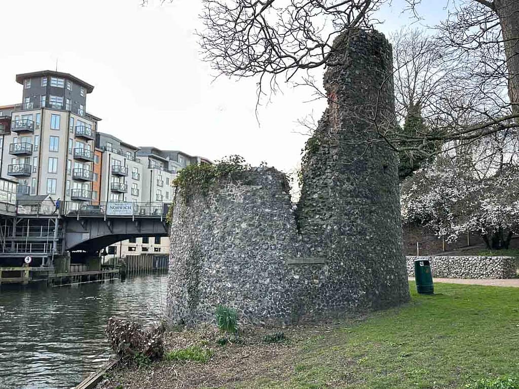
Step 3: Continue along the eastern bank to see the Eastern Boom Tower (The Devil’s Tower). Look across the river to try and spot the Western Boom Tower (Windlass Tower).
Now on the eastern bank of the River Wensum, and just a short distance from Carrow Bridge, it was time to explore the historic Boom Towers.
The Eastern Boom (Devil’s Tower)
The Eastern Boom Tower, fondly known as The Devil’s Tower, stands proudly on this bank of the River Wensum, right beside the path. As you stand here, take a moment to look directly across to the western bank. There, you can spot the Western Boom Tower, also known as the Windlass Tower, which together with the Devil’s Tower tells the complete story of the river’s regulation.
Boom Towers Norwich: Toll Collection & River Control
These medieval Boom Towers, built in the 14th century, played a crucial role in the historic river traffic management of the city via the River Wensum. The Western Boom Tower housed the windlass, a powerful winch mechanism used to raise and lower a massive Spanish iron chain that stretched from one tower to the other, effectively controlling vessel passage.
At the time, this system was an effective method of collecting trade tolls on goods being transported, by lowering the chain into the water to halt river vessels until the toll was paid.
Why is it Called the Devil’s Tower? The Story Behind its Name
Why is it called the Devil’s Tower? As the historic structure deteriorated over the years, its unique shape by 1938 was said to resemble a devil with horns. From that moment on, the name Devil’s Tower simply stuck.
Finding the Western Boom Tower (Windlass Tower) on the River Wensum
Don’t forget to look across to the western side of the river again. You may catch a glimpse of the Western Boom Tower; however, when we visited, it was quite heavily overgrown on that side, adding a touch of mystery to its riverside presence.
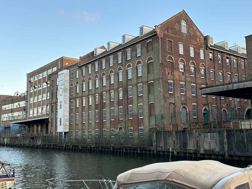
The Old Mustard Mill At Carrow Works
Step 4: Walk further along the eastern bank for a better view of the Old Mustard Mill and former Carrow Works site across the water.
Looking across the Wensum from its eastern bank, the scene is dominated by the imposing presence of Carrow Works. Even from this distance, you can appreciate the sheer scale of the historic industrial complex. The distinctive brickwork and myriad of buildings, once a hub of mustard and other food production, stand as a testament to Norwich’s rich manufacturing heritage. It’s a striking contrast to the often tranquil river, a powerful reminder of the city’s past and the industrial might that once thrummed within its heart.
Carrow Works: A Legacy of Mustard
Carrow Works in Norwich is a name synonymous with Colman’s Mustard, a brand that put Norwich on the global map. For over 160 years, this sprawling industrial complex on the banks of the River Wensum was the heart of mustard production, a place where generations of families worked and helped shape Norwich’s industrial heritage.
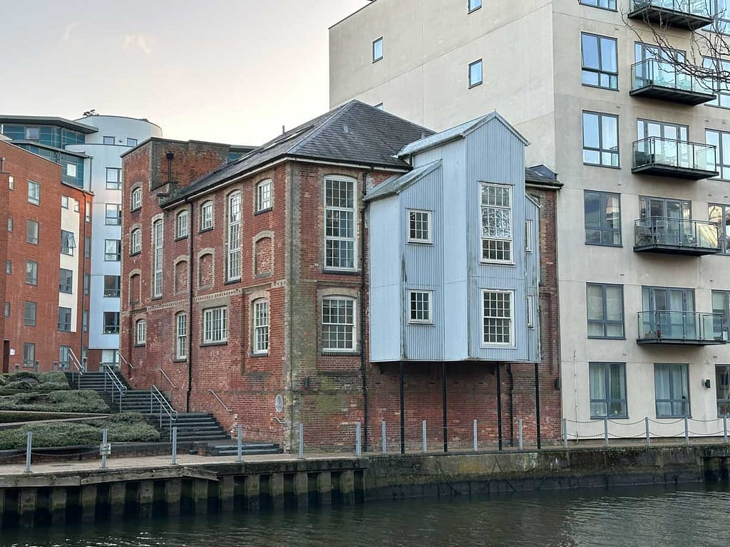
The site around the Old Mustard Mill, while no longer producing the famous condiment (production ceased in 2020), has found a new purpose. The historic Old Mustard Mill building has, in fact, been beautifully converted into apartments, forming part of the Paper Mill Yard development. It’s a fantastic example of how Norwich is embracing its past while looking to the future.
Beyond these now-residential parts, the wider Carrow Works area encompasses a rich history, from the remnants of Carrow Priory (a Benedictine nunnery dating to the 12th century) to the elegant Carrow House, once the home of the Colman family, complete with its ornate conservatory. Today, the Carrow Works site is at the centre of ambitious redevelopment plans, aiming to transform this vast area into a vibrant new quarter for Norwich.
Step 5: Head back in the other direction under Carrow Bridge, continuing along the Riverside Walk towards the city centre.
Now, heading back in the other direction, we walked under the shadow of Carrow Bridge to begin our journey along the Riverside Walk towards Norwich’s city centre.
Novi Sad Friendship Bridge Norwich: History & Significance
Step 6: Walk under the Novi Sad Friendship Bridge.
Continuing our Norwich Riverside Walk, we passed under the Novi Sad Friendship Bridge, a contemporary swing bridge built in 2001. This modern Norwich landmark stands as a symbol of international friendship between Norwich, UK and Novi Sad.
This pedestrian and cycle bridge was specifically designed to improve access between the historic King Street and the Rouen Road areas which were historically run down, and the newer Norwich Riverside development, playing a significant role in the urban regeneration of Norwich.
Lady Julian Bridge Norwich: Named After a Local Icon
Step 7: Continue under Lady Julian Bridge.
Moving further along the Norwich Riverside Walk, we then passed beneath the Lady Julian Bridge, a significant river crossing that opened in 2009. This modern bridge is named in honor of Julian of Norwich, a highly regarded historical figure in the city’s past. Julian of Norwich was famous for choosing a life of religious solitude as an anchoress, living in a confined cell dedicated to spiritual devotion.
For those unfamiliar, an anchoress (female) or anchorite (male) was a recognised medieval religious vocation. Individuals undertaking this path would embrace seclusion, being enclosed in a cell for their entire lives, dedicating themselves to prayer, contemplation, and a solitary existence focused on Christian spirituality and communion with God.
Step 8: Cross over to the western side of the river at Foundry Bridge.
From here, we then crossed over to the western side of the river at Foundry Bridge, continuing our journey along the Wensum.
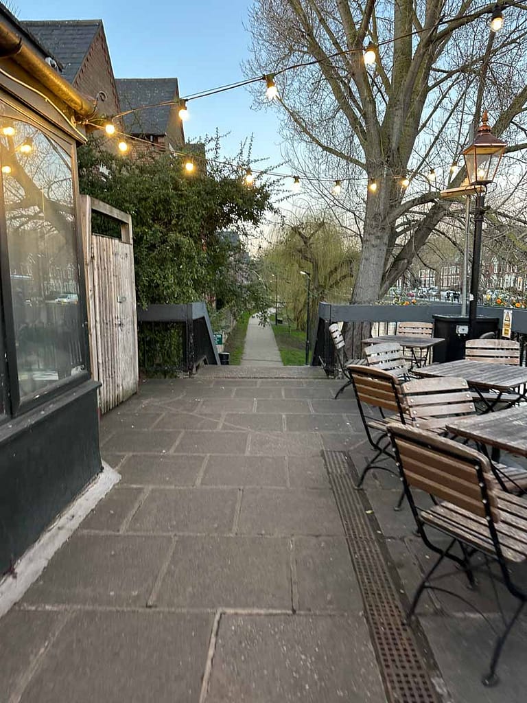
The Compleat Angler Norwich: Riverside Pub & Walk Access
Step 9: Follow the path to the right of The Compleat Angler, going down into the pub garden.
As we continued our Norwich Riverside Walk, we reached The Compleat Angler, a charming riverside pub in Norwich. Following the sign to the right of the establishment, the riverside path continued, leading us down into the pub garden – look for the sign indicating the path continues.
This delightful Norwich pub offers an ideal opportunity to pause your riverside stroll for some refreshments. Here, you can enjoy scenic views of the River Wensum and recharge before embarking on the subsequent section of the Norwich walking route.
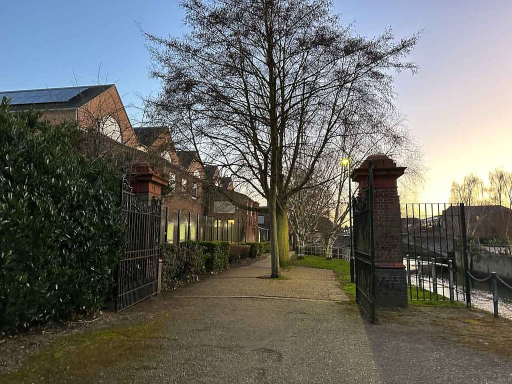
Step 10: Continue through a series of gates and under archways.
Following the path, it led us through a series of gates, alongside weathered walls, and under archways, adding a sense of discovery to the walk.
Pull’s Ferry Norwich: History & Riverside Beauty
Step 11: Arrive at Pull’s Ferry.
Pull’s Ferry is a historic flint building on the River Wensum. Originally a 15th-century watergate, it served as the unloading point for Caen stone transported by river to build Norwich Cathedral via a specially built canal under its arch. Later, it became a ferry crossing, named after John Pull (ferry operator from 1796-1841) and operating until 1943. The adjacent ferry house dates back to 1647, and both structures were restored in the late 1940s.
If you’re lucky like we were, swans and other waterfowl enjoy the last of the daylight at Pull’s Ferry, creating a truly picturesque scene.
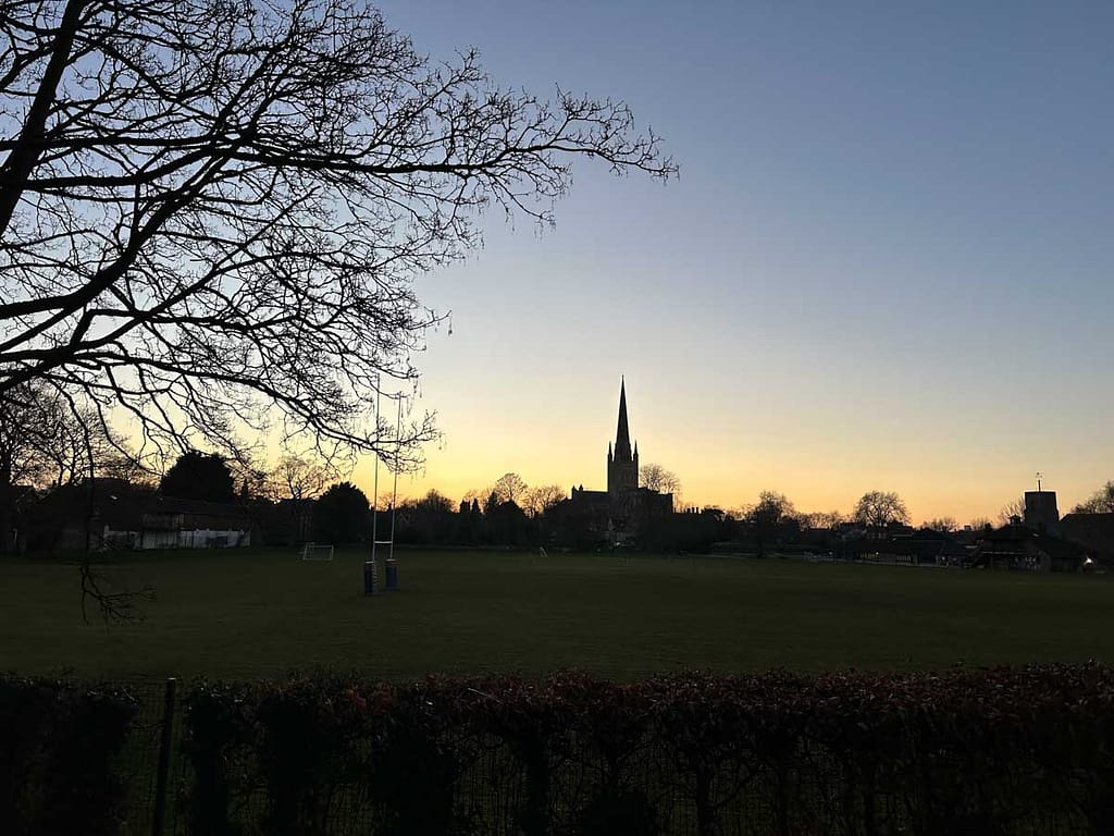
Norwich Cathedral: Views from the Riverside Walk
Step 12: Continue along the path and look left for a view of Norwich Cathedral.
Continuing along the path, remember to look left! There is a lovely view of Norwich Cathedral, its magnificent spire particularly beautiful as the sun begins to set. Now the Pull’s Ferry location makes sense, with its close proximity to the cathedral.
Norwich Cathedral’s construction began in 1096 by Bishop Herbert de Losinga. The impressive Norman building took decades to complete, with significant additions and changes over the centuries, including a magnificent spire added in the 15th century. It has served as a centre of worship and community for over 900 years. A dedicated blog on Norwich Cathedral is coming soon, so be sure to check back!!
Bishop Bridge Norwich: A Historic Crossing (Bonus View)
Step 13: Proceed along the path, crossing Bishopgate road and entering Cotman Fields road opposite The Red Lion Bishopgate. (Optional: Briefly go behind The Red Lion for a view of Bishop Bridge).
A little bonus for you: if you pop behind The Red Lion and head to the waterside, you’ll be rewarded with a beautiful view of Bishop Bridge, a historic crossing in its own right.
The current Bishop Bridge was built in c. 1343, one of the oldest in Britain still in use. Originally, the structure had two gatehouse towers and a drawbridge,but following concerns the weight of the towers were compromising the bridge’s strength and with them no longer of use, the towers were removed in 1791.
Cow’s Tower Norwich: Exploring a Medieval Watchtower
Step 14: Continue along the path to Cow’s Tower.
Now continuing along the path, we strolled through the park and came across Cow’s Tower, a medieval watchtower that speaks volumes about Norwich’s past defences.
Standing proudly by the River Wensum in Norwich, the Cow Tower is a fascinating piece of history. Built in 1398-99, this artillery tower wasn’t part of the main city walls but strategically placed to guard the northeastern approach. The tower was designed to house a garrison comfortably, likely with separate floors for living.
Swan Pit Sluice Gate: A Touch of Engineering
Step 15: Keep going, passing through an archway to reach Swan Pit Sluice Gate on the left.
Continuing again, passing through an archway, we reached Swan Pit Sluice Gate on the left – a point of interest for those who appreciate a bit of engineering and water management.
A sluice gate is a movable barrier used to control the flow and level of water in a channel, river, canal, or other waterway.
The Intriguing Iron Gates of the Norwich Riverside Walk
Step 16: Walk past Jarrold Bridge and pass through the iron gates.
We then walked through a set of large iron gates that immediately caught my eye. They seemed unusually ornate, far more elaborate than any other gates we’d encountered along the path. Their grandeur made me wonder about their original purpose. Were they perhaps a relic from a grander estate, or simply an overstated flourish to mark this particular section of the Riverwalk? Interestingly, just beyond the wall running parallel to this part of the riverside path stands the Norwich Crown & County Court building. Could this be the connection to these impressive gates?
This is something I really love about discovering these little unknowns; your imagination can travel to all sorts of possibilities. But, if you do know their original purpose, please do let me know!
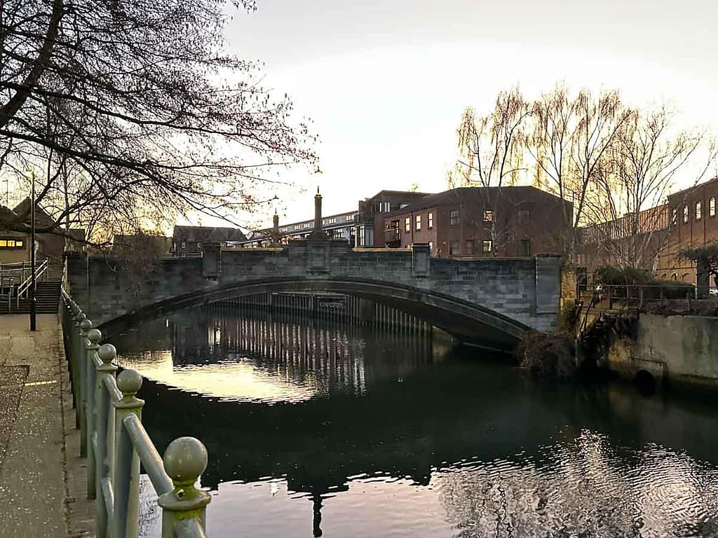
Whitefriars Bridge Norwich: Reflections on the River
Step 17: Continue until you see Whitefriars Bridge.
As we continued, Whitefriars Bridge came into view. On a calm day, it offers a beautiful reflection on the waters of the River Wensum. This spot holds significant history, as Whitefriars is home to one of Norwich’s earliest recorded bridges, originally built in 1106.
Tragically, this early structure met its end during Kett’s Rebellion in 1549. The Earl of Warwick, aiming to prevent rebels from entering Norwich, had it destroyed. The bridge you see today was constructed much later in 1925.
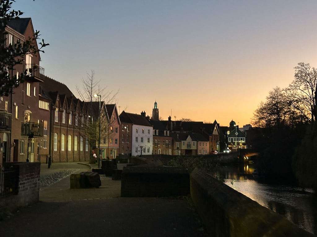
Finishing the Norwich Riverside Walk at Fye Bridge
Step 18: Continue into Norwich City Centre, ending the walk at Fye Bridge.
Our journey along the Wensum riverbanks was drawing to a close as we approached Fye Bridge. But before officially ending our walk, there was one last detail that truly captured our attention. Along this final stretch on the Quayside, we paused to admire a particularly brilliant feature: a unique row of wooden blocks designed to resemble old shipping crates. Each one serves as a small monument, proudly displaying the names of historic businesses or individuals once associated with this very area. It’s a wonderful, evocative touch that brilliantly highlights the rich, bustling history of Norwich’s riverside.
With the sounds of the city now fully embracing us and the fresh air having certainly built up an appetite, it was definitely time for some dinner in the city.
Now that you’ve got the full lowdown, what are you waiting for? Lace up your walking shoes, grab your camera, and get out there to discover the captivating Norwich Riverside Walk for yourself!
Easy-to-Follow Route Instructions: The Norwich Riverside Walk
Start at Carrow Bridge (A147). Cross the bridge from King Street.
Descend to the riverside on the right after crossing Carrow Bridge to view its structure.
Continue along the eastern bank to see the Eastern Boom Tower (The Devil’s Tower). Look across the river to try and spot the Western Boom Tower (Windlass Tower).
Walk further along the eastern bank for a better view of the Old Mustard Mill and former Carrow Works site across the water.
Head back in the other direction under Carrow Bridge, continuing along the Riverside Walk towards the city centre.
Walk under the Novi Sad Friendship Bridge.
Continue under Lady Julian Bridge.
Cross over to the western side of the river at Foundry Bridge.
Follow the path to the right of The Compleat Angler, going down into the pub garden.
Continue through a series of gates and under archways.
Arrive at Pull’s Ferry.
Continue along the path and look left for a view of Norwich Cathedral.
Proceed along the path, crossing Bishopgate road and entering Cotman Fields road opposite The Red Lion Bishopgate. (Optional: Briefly go behind The Red Lion for a view of Bishop Bridge).
Continue along the path to Cow’s Tower.
Keep going, passing through an archway to reach Swan Pit Sluice Gate on the left.
Walk past Jarrold Bridge and pass through the iron gates.
Continue until you see Whitefriars Bridge.
Continue into Norwich City Centre, ending the walk at Fye Bridge.
We use cookies to ensure that we give you the best experience on our website. If you continue to use this site we will assume that you are happy with it.